Here is a selection of the maps and physics diagrams I’ve made, provided in printable form where appropriate. Some of these are from other posts, while others are works I’m proud of but that aren’t interesting enough to warrant a post. Also see the comprehensive list of figures I’ve uploaded to Wikipedia on the Wikimedia Commons.
- Maps of the world
- Maps of Hawaiʻi
- Maps of New England
- Maps of the Pacific Northwest
- Infographics
- Poopposts
Maps of the world
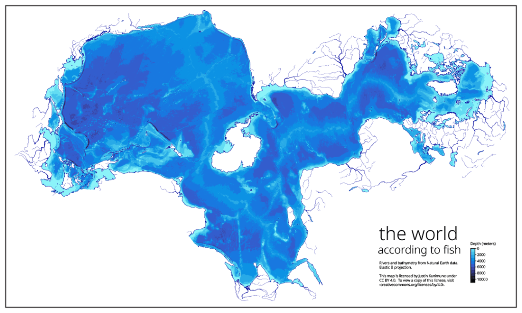
The world according to fish
Rivers and bathymetry of the world shown on the Elastic II projection. Published 2024 February under the CC BY 4.0 International License.
Maps of Hawaiʻi
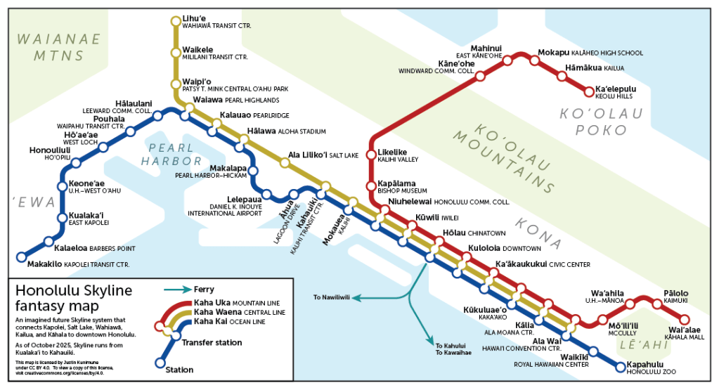
Honolulu fantasy rail map
As seen on Transit Maps by Cameron Booth. I know the odds of an elevated light rail coming to Kailua are slim, but I can dream. Who knows? Maybe they have a streetcar in their distant future. Published 2025 March under the CC BY 4.0 International License.
Unification of the Hawaiian Kingdom
Animation of the wars of unification of the Hawaiian islands from 1782 to 1810, as seen on the Wikipedia article History of Hawaii § Kamehameha I. Published 2024 December under the CC0 1.0 Universal Public Domain Dedication.

Maps of New England
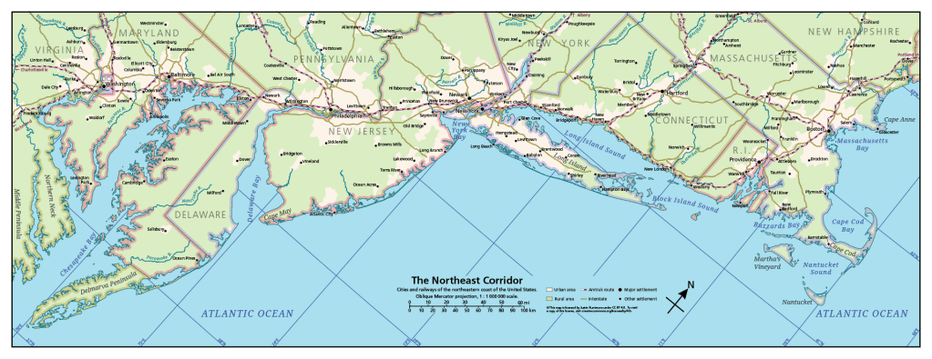
The Northeast Corridor
Cities and railways of the northeastern coast of the United States. Published 2024 November under the CC BY 4.0 International License.
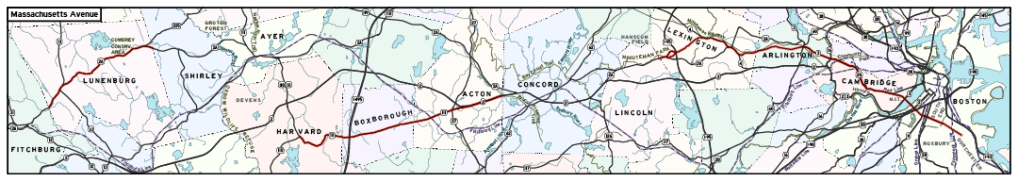
Mass. Ave.
The complete noncontiguous route of Massachusetts Avenue from Fitchburg to Boston. Published 2025 October under the CC BY 4.0 International License.
Municipalities of the Boston area
Cities and towns of the Boston area. Published 2024 December under the CC BY 4.0 International License.

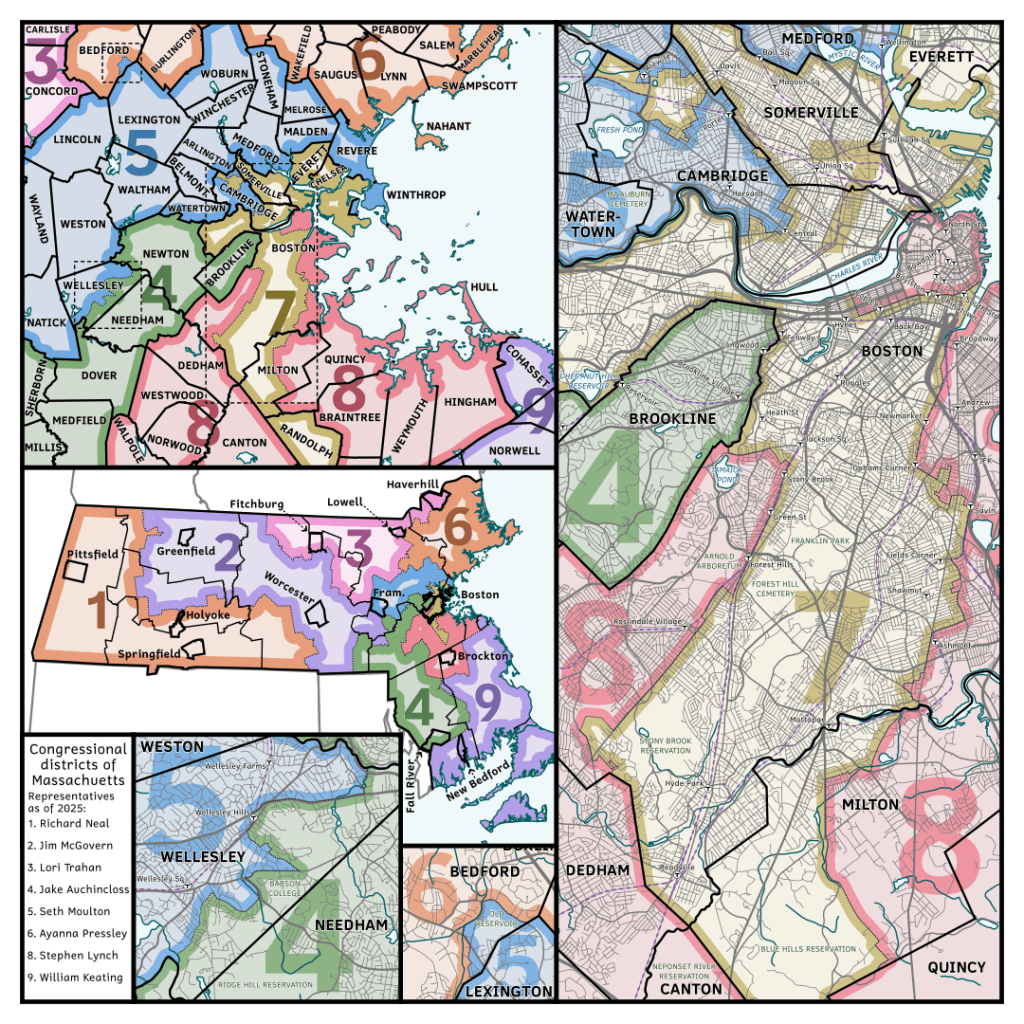
Congressional districts of Massachusetts
Congressional districts of the Boston area. Published 2025 September under the CC BY 4.0 International License.
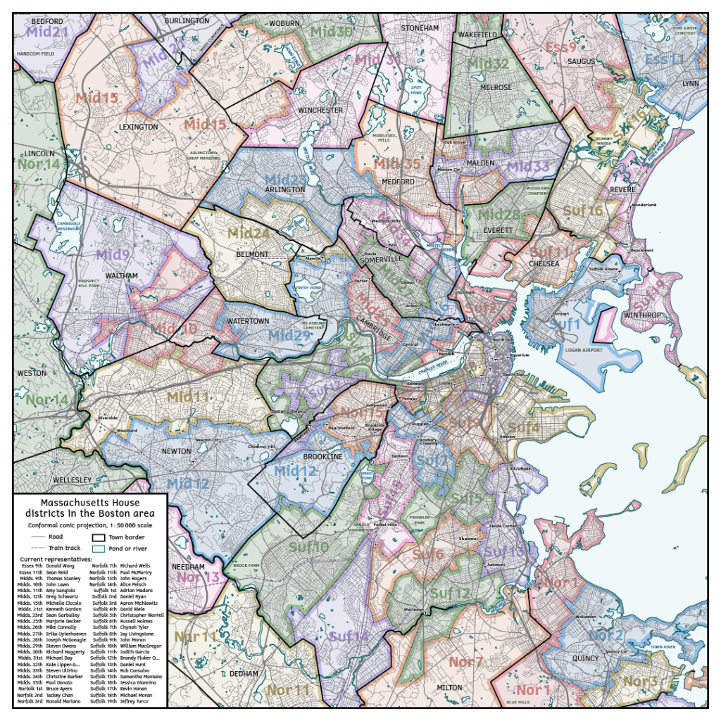
Massachusetts House districts of the Boston area
Electoral districts for the Massachusetts House of Representatives, in and around Boston. Published 2025 October under the CC BY 4.0 International License.
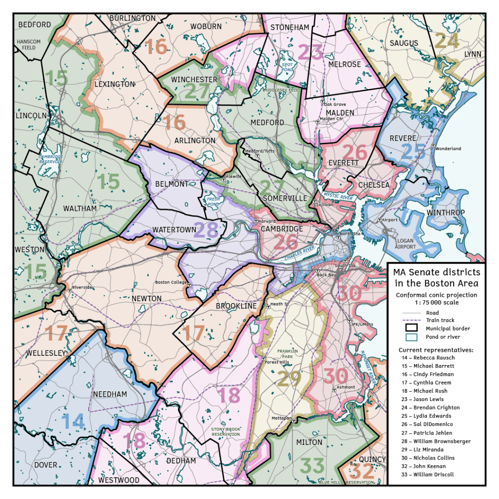
Massachusetts Senate districts of the Boston area
Electoral districts for the Massacusetts state Senate, in and around Boston. Published 2025 October under the CC BY 4.0 International License.
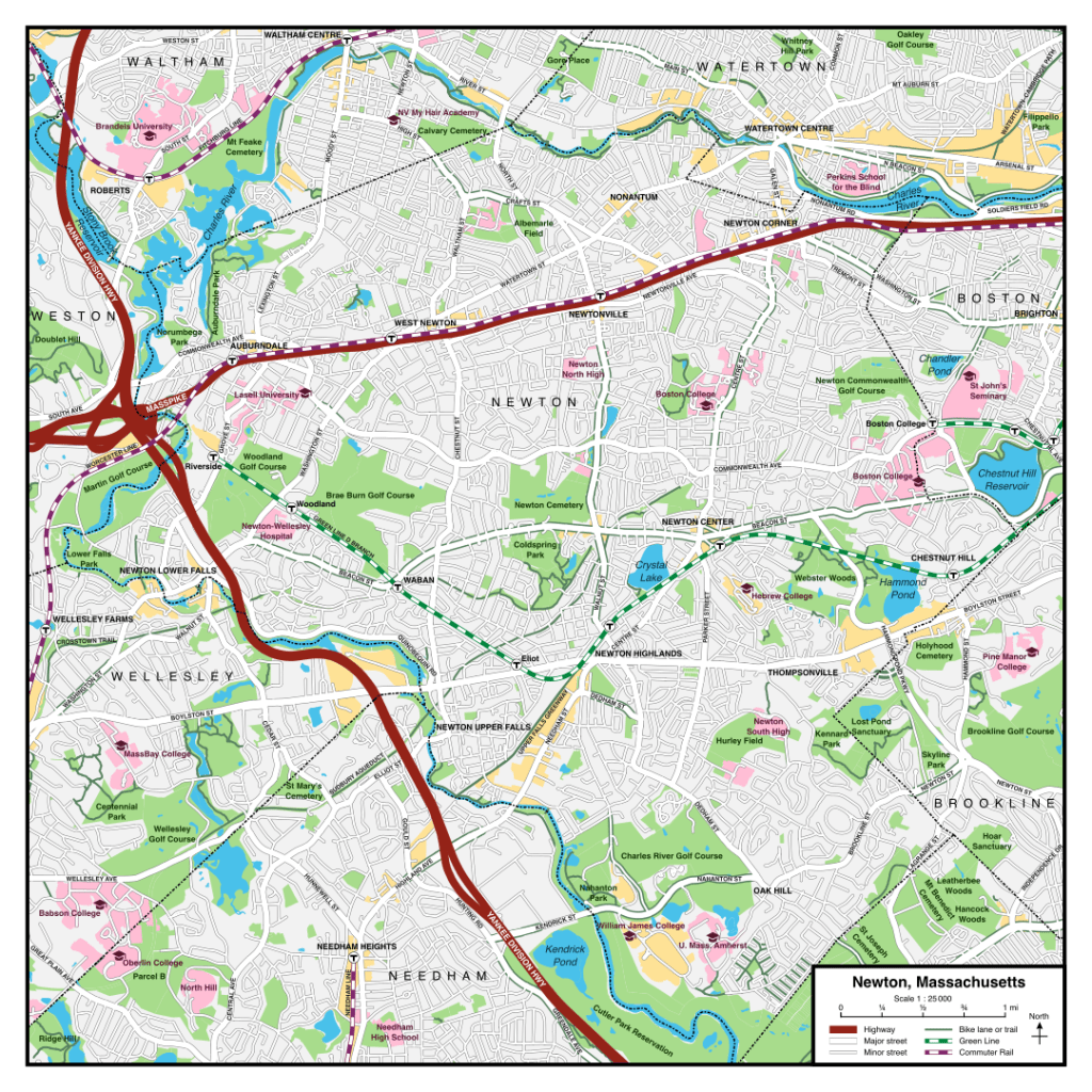
Newton
A map of the streets and passenger railways of Newton, Massachusetts. Published 2024 December under the CC BY 4.0 International License.
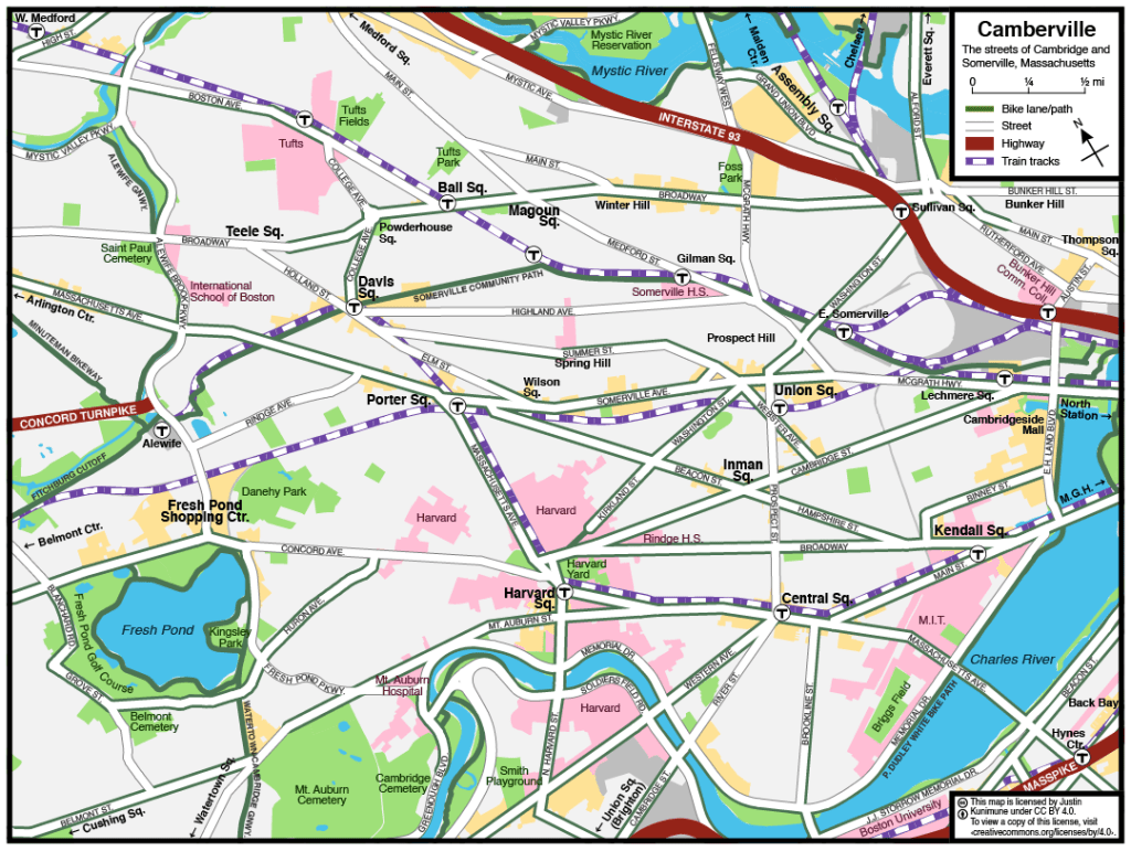
Camberville
A map of the streets and squares of Cambridge and Somerville, Massachusetts. Published 2024 December under the CC BY 4.0 International License.
Maps of the Pacific Northwest
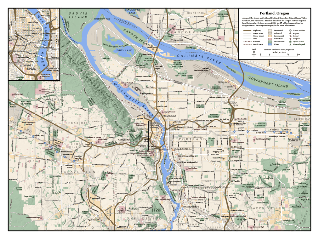
Portland
A map of the streets and buttes of Portland, Oregon. Based on January 2026 data from the Oregon Metro’s Regional Land Information System, which insists that I acknowledge their copyright over the data even though I’m pretty sure you can’t copyright data. Published 2026 January under the CC BY 4.0 International License.
Infographics
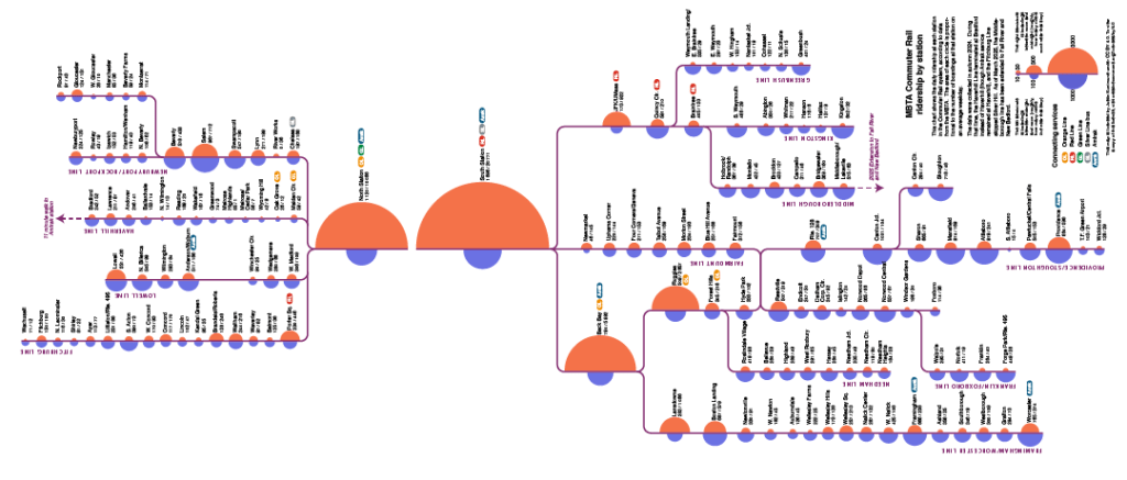
MBTA Commuter Rail ridership by station
A diagram visualizing the average daily ridership at each station in the MBTA Commuter Rail system. Published 2025 December under the CC BY 4.0 International License.
Hamiltonian Monte Carlo vs. gradient descent
An animation comparing maximum a posteriori estimation with Hamiltonian Monte Carlo in two dimensions, as seen on the Wikipedia article Hamiltonian Monte Carlo. Published 2024 March under the CC0 1.0 Universal Public Domain Dedication.

Richardson–Lucy deconvolution
The Richardson–Lucy algorithm used to fit and then overfit a 1D time-trace from a noisy measurement, as seen on the Wikipedia article Richardson–Lucy deconvolution. Published 2024 April under the CC0 1.0 Universal Public Domain Dedication.

Poopposts
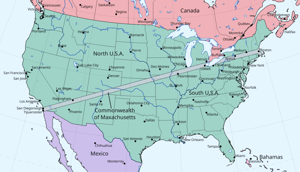
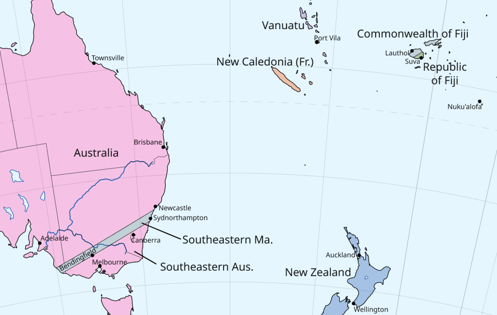
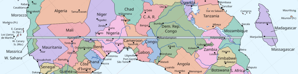
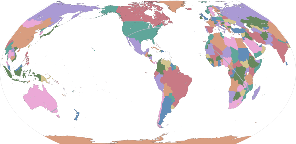
Maxachusetts
You’ve seen Megachusetts. Get ready for its logical conclusion. Published 2024 February under the CC0 1.0 Universal Public Domain Dedication.